RBGPF
61.4000

Cyclone Freddy's extraordinary journey will be reviewed in minute detail to verify whether its deadly track counts as the longest-lasting tropical storm, the world extreme weather records chief told AFP.
The cyclone crossed the entire southern Indian Ocean before wreaking death and destruction on southeastern Africa in February and March.
An international panel of experts will now spend months poring over the data to decide if it constitutes a new record in the Weather and Climate Extremes Archive run by the UN's World Meteorological Organization.
Randall Cerveny, the WMO's gatekeeper for world weather records, said the verdict rests on assessing the times when Freddy dipped below 34 knots -- 63 kilometres (39 miles) per hour -- before picking up speed again.
"The fundamental question will be: do we count the time when it was below tropical storm status?" said Cerveny, a professor of Geographical Sciences at Arizona State University who established the WMO archive in 2007.
The current record holder for the longest-lasting tropical cyclone is Hurricane/Typhoon John, which spent 31 days over the Pacific Ocean in 1994.
Freddie's total lifespan exceeded that -- but it will take months of deliberation to determine whether it constitutes a new record.
"We have to go back and do the hard work -- looking at the precise numbers and values," Cerveny said.
"It will take time but it will be a very comprehensive study."
- Experts can redefine meteorology -
The Geneva-based WMO's extreme weather archive contains a variety of records including temperature, air pressure, rainfall, wind speed, hail and lightning.
For each potential new record, Cerveny assembles a panel of world-leading experts in that field. The groups can vary in size from 10 people to more than 20, and they meet virtually.
For Freddy, scientists from the US National Hurricane Center, experts in monitoring hurricanes through satellite imagery, and national weather service meteorologists from around the Indian Ocean are all being lined up, alongside general climatologists.
"These scientists are the best of the best and so once they make a decision, I think everybody will be able to live with that," Cerveny said.
"These discussions can be really incredible. We've actually in past discussions rewritten some of the fundamental definitions in meteorology," he said, citing how lightning flashes are defined.
"I expect that's going to be the case here, when we make a decision as to whether we will work with the timeframe when Freddy was below tropical storm status."
- Freddy's deadly impact -
Freddy developed off north Australia and became a named storm on February 6.
It made landfall in Madagascar on February 21, crossing the island before reaching Mozambique on February 24, claiming lives in both countries.
Freddy tracked over Mozambique and Zimbabwe, bringing heavy rains and flooding.
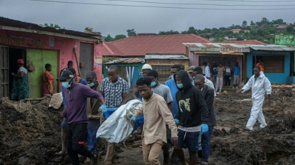
It then looped back towards the coast, regained strength and hit Madagascar again before heading back over Mozambique and Malawi, where it caused around 500 deaths, with floods and mudslides sweeping away homes, roads and bridges.
Tropical storms derive their power source from warm water and therefore weaken over land. Freddy dissipated around March 14.
"The thing that saved it and made it such a long duration was continually moving back out over warm water," said Cerveny.
Once he gets the full raw data from the weather monitoring stations around the Indian Ocean, Cerveny will assemble a background report for the panel to kick off their deliberations.
"I have no doubts that we will find the right answer," he said.
- Records help track changes -
The current record holder, John, was determined from aircraft reconnaissance.
"Looking at the track data, it slipped below tropical storm status," said Cerveny.
"I'm talking to the people that made that determination and trying to figure out how did they decide? That is something we'll want to talk about."
Freddy could also be up for other records, such as the furthest-travelling storm.
But why does establishing records matter?
"The most important is climate change. If we want to see how things are changing we need to have a good baseline of what's happening now," said Cerveny.
"The water that's dropping from these tropical cyclones does appear to be increasing over time. We see wetter and wetter tropical cyclones. A lot more flooding."
Weather extremes data is also used for civil engineering planning: for example, the maximum wind speed that a bridge must be able to withstand.
Cerveny added: "Also, people in general like to know extremes."
S.Scheidegger--NZN